 nicolanoe.it Un sito dedicato agli spazi verdi e all'ambiente – A site dedicated to green spaces and the Environment


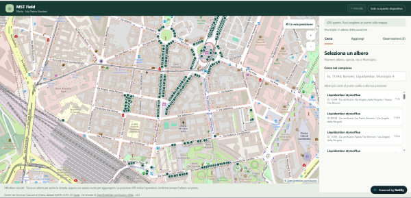
Data source: OpenData Comune di Milano.
Data to be collected:
Position, species, overall tree health, trunk diameter, crown diameter and tree height.
The app has integrated search, add and observation sections, and you can edit trees directly from their card.
You can search by number or street, complete observations without completing all measurements, and cancel the last operation. The GPS shows your position with a blue dot that updates while you are walking and identifies the municipality.
Manual entry of coordinates without GPS has also been added, as well as a history of the operator, date and modifications made.
The association of trees with streets has been updated, with uncertain cases left to be verified.
Currently, data and history remain in the browser used in local mode. To share them with multiple people, activate the shared database.
https://mstpilot.netlify.app/


